Open Pit Mining
Every mine is unique and so should your monitoring plan. Each InSAR monitoring program is custom developed to fit the monitoring needs of our customers.
Complete the form to request product details, pricing, schedule a demo, or to discuss an upcoming project.
Radar satellites have been collecting images around the globe since the early 1990’s. Urban and rural locations worldwide have archive data available for InSAR analyses. Contact us using one of the options below and work with our team to understand what data is available for your project site.
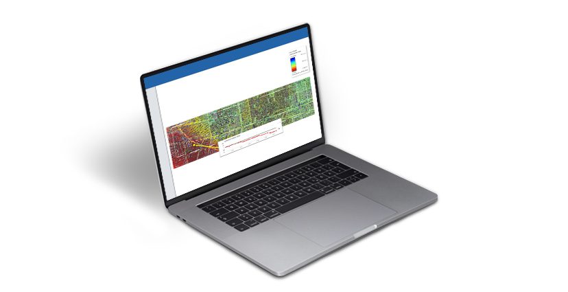
3vG can conduct a data archive search of all of the relevant satellite image databases to determine data availability over your specific area of interest. If sufficient imagery is available, we can conduct an InSAR analysis of these images to measure displacement over the associated time frame. An example of the type of InSAR results generated from historical archive images for a portion of a major U.S. city is shown in the figure to the right.
We are very impressed with this data. We realized that we have problems right now in several areas caused by rain. We saw them shown in red on the map.”