Open Pit Mining
Every mine is unique and so should your monitoring plan. Each InSAR monitoring program is custom developed to fit the monitoring needs of our customers.
Complete the form to request product details, pricing, schedule a demo, or to discuss an upcoming project.
Displacement DataStream is the latest advance in InSAR processing that represents a new class of early risk identification. Displacement DataStream is 3vGeomatics’ advanced satellite InSAR monitoring service that rapidly updates displacement measurements after each new image acquisition.
Traditional in-ground instrumentation for monitoring field performance can only provide single location measurement data after the time of installation. Meanwhile, 3vG can incorporate satellite based historical measurements over a region of interest dating back to 1992 into the ongoing Displacement DataStream, to provide more context, more accuracy, and more benefit.
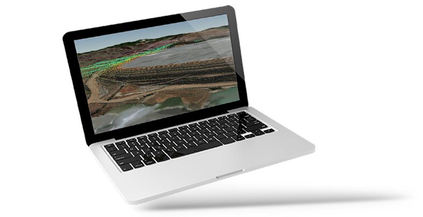
Displacement DataStream includes regular updates to the time series displacements, average movement rates, and displacement and acceleration detection contours on the latest data. These are delivered through 3vG’s Motionary web platform within 24 hours of 3vG receiving each new satellite image. Typical deployments of InSAR technology involve periodically delivering individual products or packages. This puts the burden of data reception, file management, and integration on the end user rather than enabling them to interpret and analyze the results. Displacement DataStream is a move towards displacement monitoring data as a connected service where new and updated measurements are streamed directly to Motionary. This innovative process greatly increases accessibility to InSAR information, end-user analysis, and proactive risk mitigation.
In the past, the processing of InSAR has required a bulk input of SAR data for accurate processing and reporting of results. Instead, 3vG has developed a unique system of injecting only the newest image into the existing dataset allowing for rapid low latency turn-around times of 24hrs or less for each new image. This means that customer datasets are updated in near-real-time, bringing a new stage in satellite risk mitigation and remote monitoring.
Displacement DataStream includes 3vG’s proprietary tools to help direct users to areas of critical interest. First, Acceleration Detection Polygons identify and highlight areas of accelerating displacement. This is done by comparing the newest image against previous images to determine changes in the rate for an area.
Second, Displacement Detection Polygons delineate the perimeter of trustworthy displacement areas based on robust statistical models. These layers, delivered to Motionary, help direct attention to areas where displacement is occurring.
These two tools reduce the amount of time spent sifting through data, giving engineers more time to follow up on identified areas, corroborate measurements, and mitigate risk.
For multi-perspective monitoring, 3vG continues to include the 3D direction of displacement. This includes the East-West and Up-Down directions of movement.
We are very impressed with this data. We realized that we have problems right now in several areas caused by rain. We saw them shown in red on the map.”