Complete the form to request product details, pricing, schedule a demo, or to discuss an upcoming project.
Project Overview
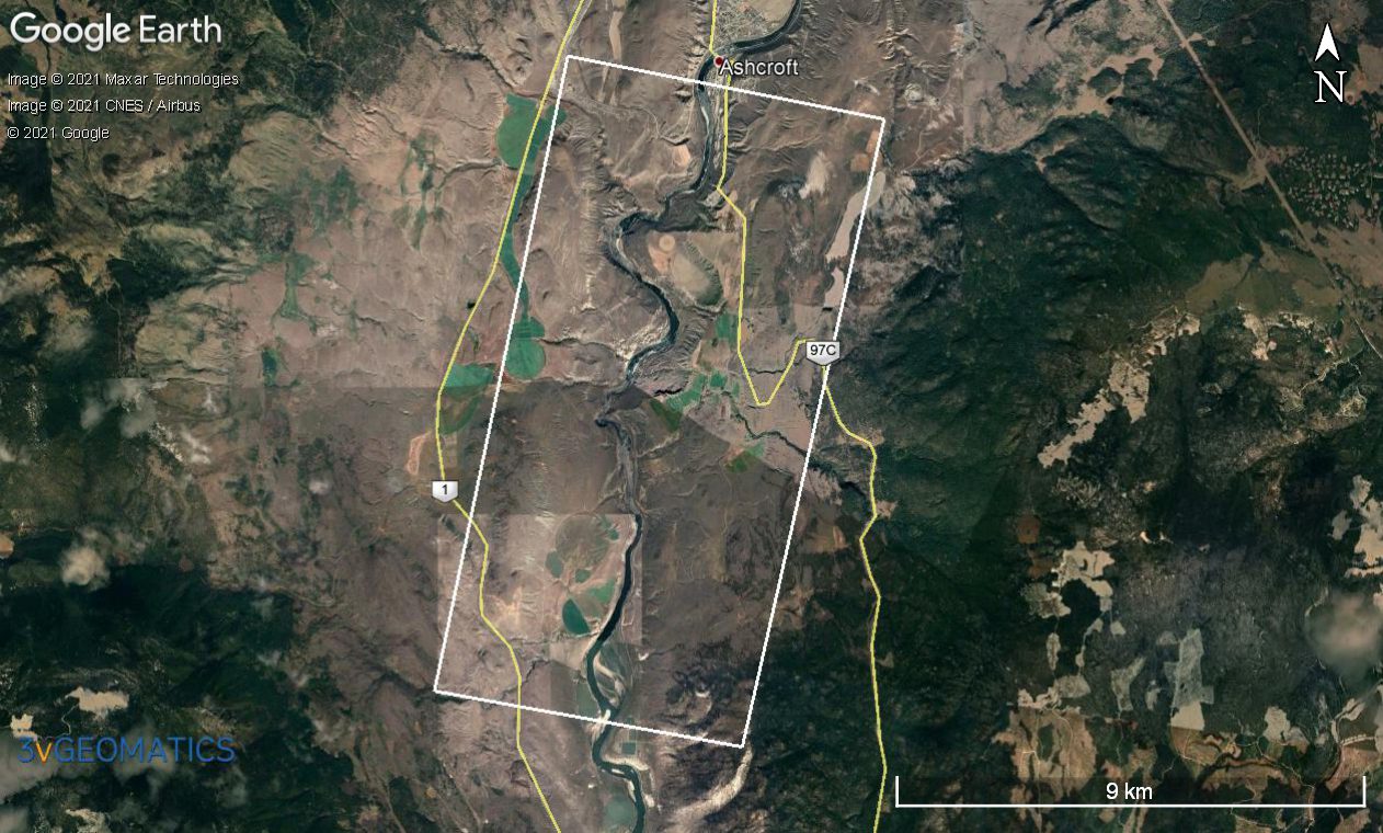
3vGeomatics conducted a historical analysis and processed data on a transportation corridor along the Thompson River near Ashcroft, British Columbia. This 10-kilometer stretch has numerous slope instabilities that threaten a major highway and two railways.
Goals
Solution/Results
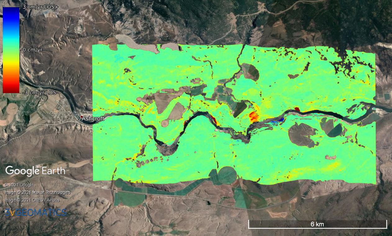
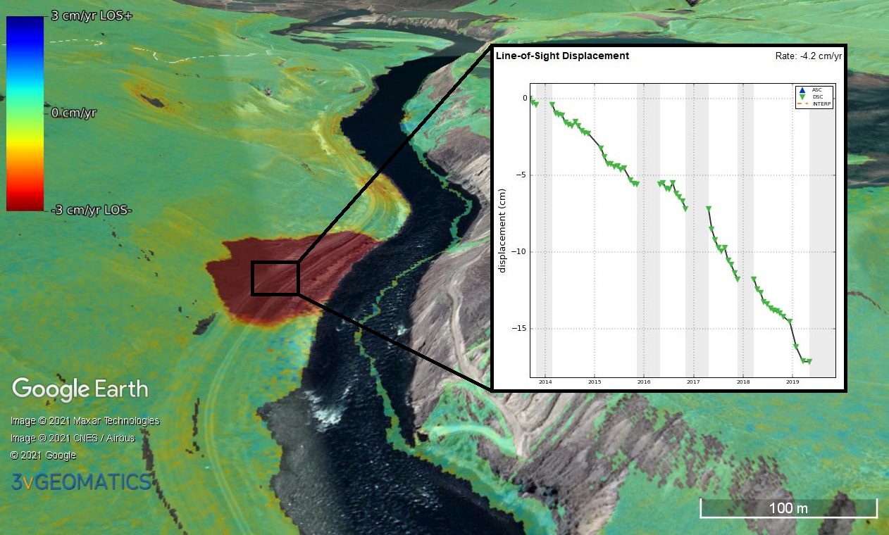
3vGeomatics analyzed 86 RADARSAT-2 images acquired between September 2013 and November 2019. Focusing on a zone 18 km wide by 52 km long, displacement was identified in 18 distinct areas. The fastest displacement measured was over 16 cm/year, while the slowest was less than 1 cm/year. The high sensitivity of InSAR measurements facilitated the identification of unknown displacement, as well as locating the extent of known displacement areas. The results were presented as a rate map and as thousands of time series graphs showing displacement histories for points within the displacement areas.
Benefits
3vGeomatics provides cost-effective and efficient solutions for both historical analysis and ongoing monitoring of geohazards that threaten transportation infrastructure. Our monitoring services can be used as a standalone monitoring system or to complement in-situ instrumentation. InSAR’s wide coverage, density, scalability, sensitivity, and archive availability is a preemptive measure against geohazards over vast regions.