Complete the form to request product details, pricing, schedule a demo, or to discuss an upcoming project.
Protecting Infrastructure from Meters to Miles
Location:
Tulare Lake Basin, California
Sector:
Water Management
Product/Service:
Ongoing Monitoring
Project Overview
The California Aqueduct transports water over 700 miles across the interior of California and is the backbone of the California State Water Project. The aqueduct crosses through the Tulare Lake Basin, where there is ongoing water pumping from underground aquifers. Government agencies are entrusted with regulating the pumping of water from these aquifers as well as monitoring the condition of the aqueduct.
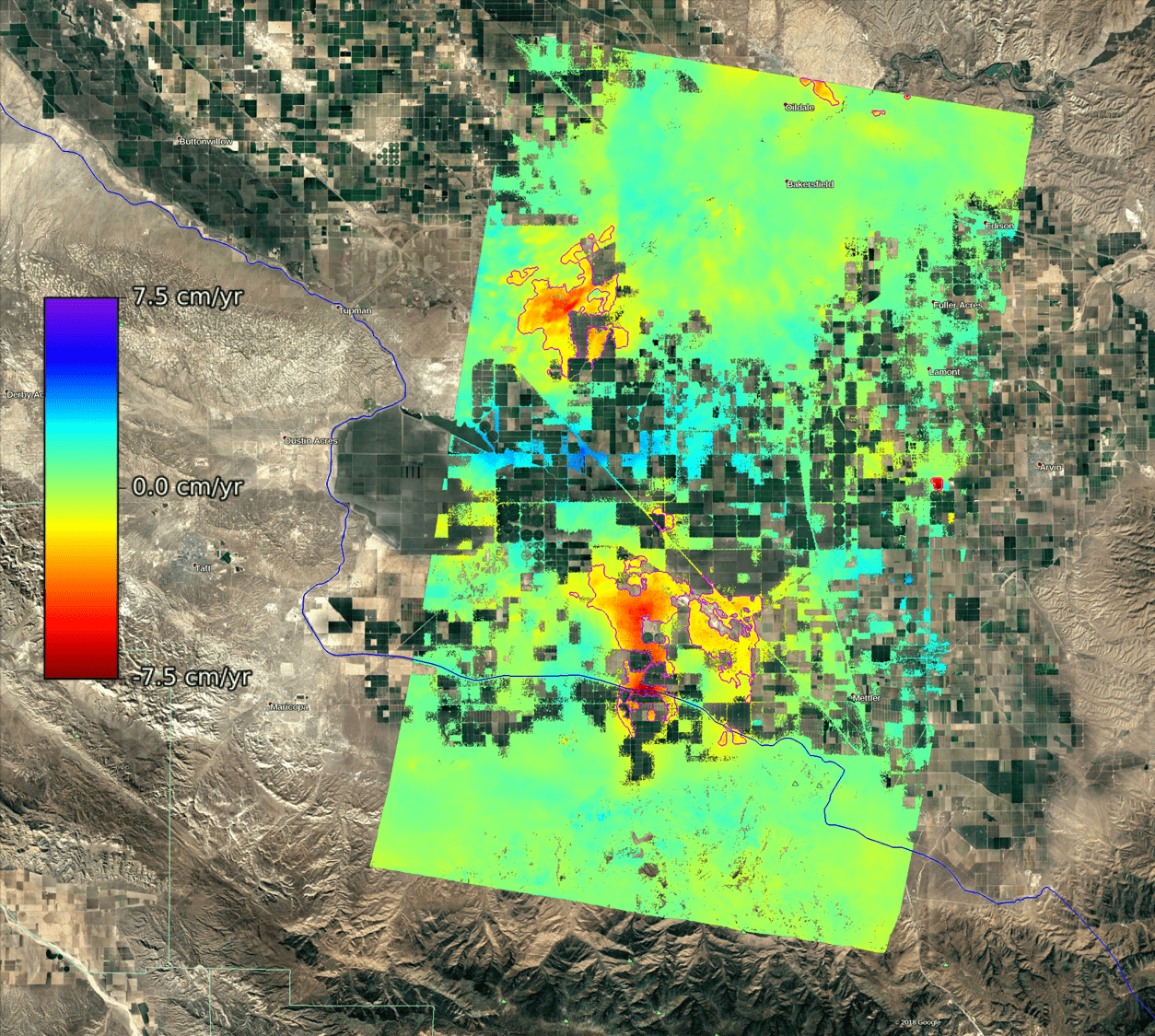
3vG processed historical data over two large sections of this basin to measure large-scale displacement caused by aquifer pumping and to detect potentially damaging smaller displacement regions along the California Aqueduct.
Displacement rate measured over a 1500 km² area to the south of Bakersfield, California showing multiple large displacement regions. The purple contour highlights regions of significant displacement while the blue line shows the path of the California Aqueduct
Challenges
The California aqueduct is over 700 miles long. If a sufficient amount of subsidence occurs anywhere along that length, water can pool, preventing downstream flow. Displacement locations can be very localized (less than 10 meters across). If left unchecked, reparation costs can be significant.
California’s aquifers cover about 20,000 square miles of land through the Central Valley. Ground water extraction and replenishment causes large-scale subsidence and uplift of this area. State law now requires comprehensive displacement monitoring of aquifers for groundwater management, but a huge number of ground instruments and a significant number of field inspections would be required to cover such a vast area. In addition, locating a stable reference point is difficult for surveying based approaches.
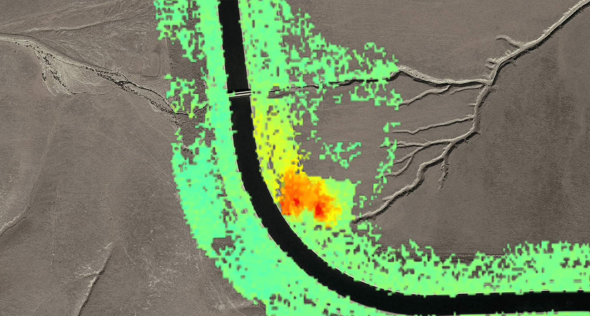
Localized (<100 m) displacement area detected along the California Aqueduct with a measured displacement rate exceeding 5 cm/year.
Solution/Results
3vG analyzed 40 TerraSAR-X (TSX) images taken over two 1500 km2 areas of the Tulare Lake Basin between 2015 and 2016. The short, x-band wavelength of the TSX satellite enabled 3vG to produce a high-resolution (3 m) map of displacement over 85 km of the California Aqueduct. A low-resolution map was also produced at 30 m resolution to reveal large-scale displacement across the 3000 km2 imaged area.
Five large displacement zones were identified, each with displacement rates exceeding 5 cm/year and a combined area greater than 500 km2. Almost 20 km of the California Aqueduct is within these large displacement zones. The high-resolution map revealed two additional small (100 m), localized areas of the aqueduct that were subsiding.
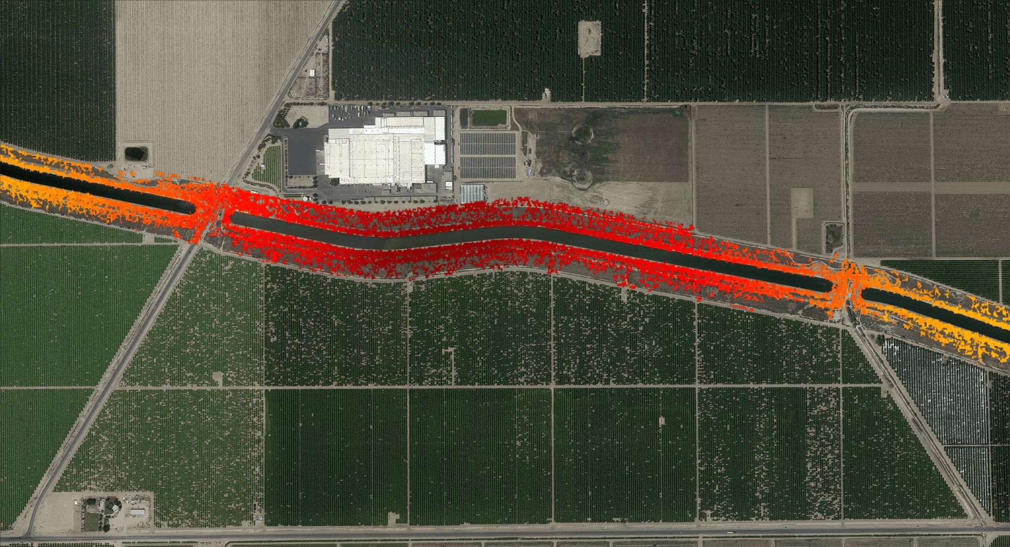
Derived displacement motion for one area within the Tulare Lake Basin showing changes to the displacement rate over time, potentially related to periods of greater water pumping from the aquifer.
Benefits
Simultaneous monitoring of linear infrastructure spanning hundreds of kilometers
Identification of the boundaries of large displacement areas, enabling total volume displacement estimates
Monitoring of known movement areas for growth and acceleration
Discovery of previously unknown displacement areas requiring remediation
Remote sensing approaches that leverage satellite imagery provide millimeter-scale displacement measurements across the entire state, with data points every 3 to 20 meters. No ground instruments or field inspections are necessary.
Identifying localized displacement early along aqueducts, when still at the millimeter or centimeter level, reduces the cost of reparation.
Conclusion
3vG has a demonstrated capacity to monitor large areas while providing sensitivity to displacement on scales from 10 m to 10 km. InSAR monitoring is ideal for identifying previously unknown areas of displacement and for revealing the full extent of displacement regions. With Sentinel data, 3vG is growing its large-scale monitoring capability to allow for monitoring of areas over 100,000 km2 in size.