Complete the form to request product details, pricing, schedule a demo, or to discuss an upcoming project.
Engineers at large infrastructure projects, like mines, tailings storage facilities, pipeline right-of-ways, and transportation networks, have access to vast amounts of data. These asset owners and operators monitor hundreds or thousands of data points, looking for signs of ground instabilities and geohazards. Finding emerging risks in large datasets can be a challenge. Without the right tools, or complex data analysis, developing risks may go unnoticed.
For remotely sensed data such as InSAR, product deliveries can contain hundreds of thousands, or even millions of data points. Each of these points has their own story to tell. Manually searching through all that data, looking for geohazards is time consuming and imprecise.
To solve this problem, 3vG has developed two geospatial tools that quickly direct the user’s attention to areas where displacement is occurring—Acceleration Detection Polygons and Displacement Detection Polygons. Together, these tools help engineers and project owners quickly identify important measurements. These two tools reduce the amount of time spent sifting through data, giving engineers more time to follow up on identified areas, corroborate measurements, and identify risk.
Displacement Detection Polygons direct attention to areas where displacement is occurring.
Typically, processing techniques assume a uniform noise floor, where all points within the image have a similar noise floor. However, the level of noise varies across the image and over time as ground and atmospheric conditions change. Therefore, the detection limit for displacement varies as well. This means that subtle displacement can be found in areas of high quality data, while lower quality data may require additional measurements.
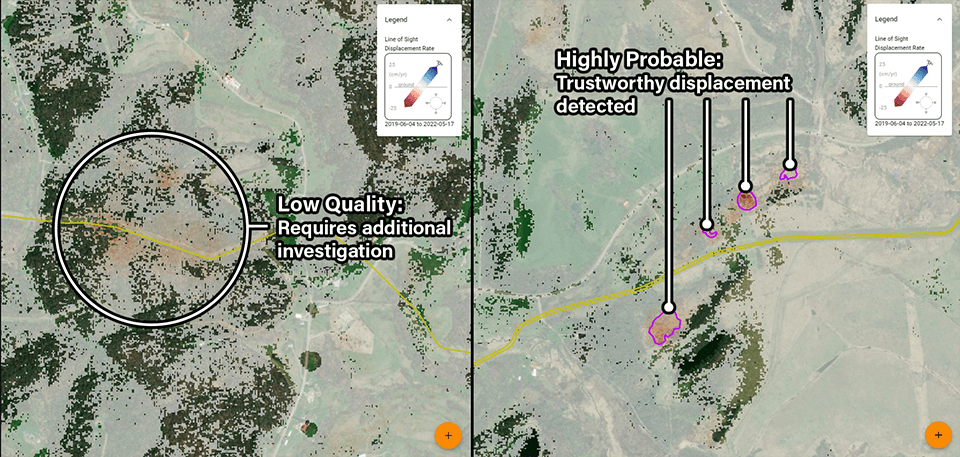
3vG’s Displacement Detection Polygons outline areas where displacement is above the noise floor, enabling detection for both subtle and significant displacement areas to be detected with confidence.
Detection levels are classified into four categories: possible, probable, highly probable, and extremely probable.
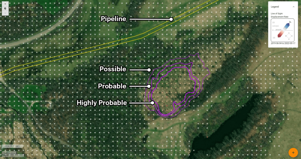
These levels provide a way to distinguish between displacement signals and noise and to determine the reliability of the displacement data. A new set of detections are delivered with each update of the Displacement DataStream for up-to-date results.
Heavy rain or new operational activity, like mining, tunnelling, or clearing of right-of-ways, may cause the ground to change its movement behaviour. 3vG’s Acceleration Detection Polygons highlight areas where displacement is just starting to begin, or velocity is increasing. [Figure 3]
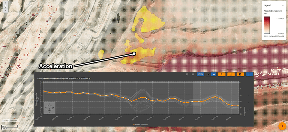
A proprietary algorithm compares velocities over time using historical data. Evidence of acceleration is aggregated over different time periods, minimizing the risk of false positives or overlooking important information. Each time a new image is added to the DataStream, considerations are given to the noise floor and variations within the data, to deliver a new set of polygons for up-to-date results.
Both Displacement and Acceleration Detection Polygons are delivered via 3vG’s Displacement DataStream at no additional cost. The polygons are visible in Motionary as toggleable layers.
Displacement Detection and Acceleration Polygons are possible for most projects; however, some limitations apply. Certain satellite data configurations may limit the ability to produce Acceleration Detection Polygons.