Complete the form to request product details, pricing, schedule a demo, or to discuss an upcoming project.
Jon Leighton brings 15 years of British Army geodetic experience and a passion for geospatial innovation to his role as Director of Operations at 3vGeomatics, After transitioning from academia to commercial InSAR, he now leads technical excellence and cross-brand integration within Orica Digital Solutions, driving safer and smarter solutions for mining and infrastructure worldwide.
After 15 years in the British Army and a transition through academia to commercial InSAR, what drove your career pivot and shaped your leadership style?
The Army was great, but I suddenly found myself more academically ready to really learn something, and I was keen to fix my lack of qualifications. I also wanted a shot at a real second career, and at 35, the timing was perfect.
I lean a lot on my Army experience for leadership. Despite its image, the Army really teaches you to do your level best for the people you mentor.
As Director of Operations since 2019, can you walk us through your typical day, balancing technical oversight, project management, and team leadership within 3vG?
Happily, there isn’t really a typical day; there’s lots of variety. Last week, I provided InSAR education to some Mongolian Geotechs, I wrote part of a technical note for the Large Open Pit project, and I met with managers to discuss their goals for FY2026. Supporting Business Development is a big part of the role these days, which includes triaging BD requests and making sure proposals are well-tuned and executable.
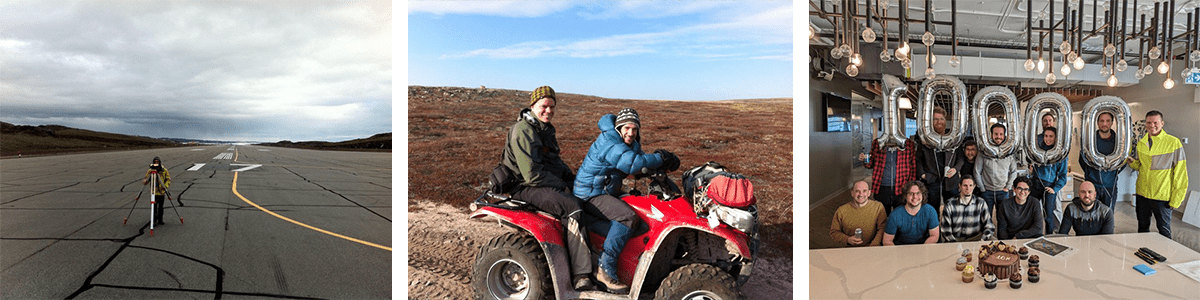
The Rapid Report changed the InSAR industry back in 2014, how did you influence these innovations?
I remember working on Rapid Report #1. We were there until midnight trying to make it work; it was pretty hacky at the start. We had some last-minute glitches, but we were determined to make the 24-hour deadline, and we did so by a whisker. The next few weeks were hectic as we switched from the more sedate pace of academic InSAR to on-demand monitoring. Things eventually fell into place and now Rapid Reports fly out of the door at the rate of around 50 per week, many requiring zero intervention.
In the startup days, everyone did everything and so I wrote a lot of the early InSAR processing tools. Thankfully things have changed and have actual computer scientists writing our code nowadays.
You’ve worked on projects across mining, pipelines, urban infrastructure, permafrost, and Arctic fieldwork. Can you share a story that best illustrates 3vG’s impact in one of these environments?
Our early research work in Permafrost was funded by the Canadian Space Agency; using remote sensing effectively for such a vast area is such a great use of the technology. We then managed to commercialize it, delivering Development Suitability Maps for many remote communities in Nunavut. The maps, produced for the Government of Nunavut, showed developers which areas were not suitable for construction. This was based on things like elevation data, InSAR results and proximity to water.
As part of Orica Digital Solutions’ Geosolutions group, 3vG collaborates with brands like GroundProbe and Syscom Instruments. How does cross-brand integration shape your team culture and client offerings?
Our integration efforts so far have mostly been commercial. We’ve set up a ticketing system to support external requests when an opportunity arises from GS5 sales. We provide things like archive data checks, preliminary processing and technical support during meetings with clients. 3vG business development people often provide support with proposals and pricing.
Technical integration efforts are now underway. NavStar’s GeoExplorer can now pull our InSAR results directly from the cloud, removing a lot of needless manual work for users. Work has also begun on the successor to GeoExplorer and this is being led by the original lead developer for our platform, Motionary. 3vG’s office is abuzz with cross-collaboration, providing office space not only for people working on the new platform and Motionary, but also for RST developers working on Affinity.
What emerging trends in satellite sensing or analytics excite you most for the next 5–10 years?
There are some big improvements coming. Because of the way the satellites orbit, InSAR is not sensitive to displacement in the north-south direction, but a new generation of satellites, already launched, will change that, probably as early as 2026. We are working closely with the satellite operator and we’ve already published a paper with them showing that full 3D InSAR works.
The recently launched NISAR satellite will provide free data globally, tuned specifically for detecting displacement in vegetated areas. There are likely very many new users who will now be able to take advantage of InSAR at a price that was previously out of reach.
We have a lot of exciting plans for Motionary, which is already an industry-leading InSAR platform. Obviously, we want to build support for 3D and NISAR, we want to open up our API to third-party platforms, and we want to explore value-added type products like displacement gradient mapping.
Any final thoughts, perhaps a personal insight, memorable experience, or advice for those interested in geospatial monitoring and InSAR?
Last year, we celebrated our 10,000th Rapid Report. Rapid Reports changed InSAR!