Complete the form to request product details, pricing, schedule a demo, or to discuss an upcoming project.
We’re excited to share that 3vGeomatics (3vG), a key part of Orica Digital Solutions’ Geosolutions portfolio, is enhancing our ground movement monitoring service by integrating data from the NISAR (NASA–ISRO) SAR satellite. By leveraging NISAR’s advanced radar capabilities, we now deliver more reliable, cost-effective insights, especially in remote and vegetated areas. Here’s a closer look at the technology behind it.
NISAR is the first satellite mission to use dual radar frequencies: L-band and S-band, to systematically map Earth’s surface. Its L-band radar, with a longer wavelength (~240 mm), penetrates vegetation, where traditional SAR data struggle. The S-band radar is currently used for targeted applications in India.
NISAR directly addresses key challenges faced by infrastructure operators across mining, energy, transport, and government sectors:
Risk Management
Monitoring in Vegetated and Remote Areas
Scalable Network Monitoring
Timely Insights
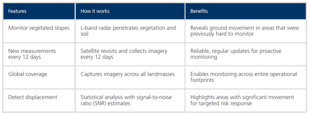
3vG’s NISAR-powered service makes it easier and more cost-effective to monitor ground movement, regardless of the location of your assets. From dense forests to remote terrain, it delivers reliable insights at scale.
What that means for you: